Enchanting Mysterious Durkee’s Run
By Mabel Louise Whitehead Harlan
Originally published in Weatnenotes, Vol. XII, No. 2, March 1983
Editor’s Note: Mabel Louise Whitehead Harlan (1877-1950) wrote the following article on Durkee’s Run in 1949 when she served as Assistant Curator for TCHA. Her bequest to TCHA became part of the Association’s Revolving Publications Fund. A booklet of papers by Mrs. Harlan was published with money from this fund in 1954. The Weatenotes editor (1983) has added the bracketed information and footnotes to the article.
One would never suspect today that the little stream known as Durkee’s Run once furnished power to run busy mills; that the deep valley in its lower course, known as Durkee’s Hollow, once was reputed to have been the rendezvous for robbers, especially horse thieves, and to have been the scene of buried treasure. Such is its history, however, according to records found in the late Dr. William M. Reser’s book “Grist Mills of Tippecanoe County” and in his notes filed in the TCHA museum.
The stream had its source in a marsh or bog that lay in the neighborhood of the intersection of Earl Avenue and South Street where stood the old “Wagon Works” now the property of the Warren Paper Products Company. At the time of the settlement of the county the surplus water of this marsh drained sluggishly over the crooked course south and southwest until it reached the present line of Main Street. This upper course today consists of straightened artificial channels.
From Main Street it still follows a winding southwesterly course as formerly, its original channel formed by a natural depression of the land. It passes successively through the land of the Pythian Home and the Old Tippecanoe County Fairgrounds to the Ninth Street road. From there it meanders picturesquely through the Country Club ground and the northern part of the St. Joseph Orphanage property to the Fourth Street road.(2) Here it enters a deep, narrow valley bordered by rugged wooded hills known as Durkee’s Hollow [this is the area being proposed for development, overlooked at present by the newly constructed Bluff apartments.] After emerging from this hollow under the Big Four and Monon Railroad tracks, it crosses a narrow strip of bottomland and empties into the Wabash River south of Shamrock Park. The entire length of its course does not exceed four miles.
The stream was named after Dr. John Durkee and his family. Dr. Durkee was the first physician to settle in Tippecanoe County. According to Dr. Reser, he was a post-surgeon in the war of 1812 and made his entry of land in Tippecanoe County a little southeast of the present village of Shadeland in 1824, the day after William Digby acquired the plot for the town of Lafayette. [Dr. Durkee came to Tippecanoe County from Vigo County where he operated a ferry beginning in 1819.] Dr. Durkee, however, did not contemplate the laying out of a town. His object was to acquire land for agricultural purposes and as a home for himself and family. He and his son David, both separately and jointly, acquired by entry and purchase, numerous other tracts on the Wea Plains near Shadeland and land south of Lafayette that was little more than swamp and hillside, but across it sourced the little stream that was named for the Durkee family.
The Durkee family is given credit for establishing the first gristmill in Tippecanoe County. It was erected on Durkee’s Run near where it emerges from the deep hollow and near where the Big Four, Monon, and Wabash railroads now cross the stream.
Dr. Reser stated that “The exact location where the mill stood is not known today because of the artificial changes produced in the topography by construction of these line, but it was somewhere between the fills of the Monon and Big Four probably nearest the Monon just east of the fill.”
The mill was known as a “corn cracker” and was a great boon to the early settlers of Tippecanoe and adjoining counties. It is recorded that settlers in Carroll County near Delphi as early as 1826 brought their corn in a pirogue down the Wabash to a little corn-cracker mill near where Lafayette now stands, which could have been none other than this mill on Durkee’s Run.
In those early days Durkee’s Run had a constant dependable flow of water. It not only received the drainage from the marsh and surface drainage from the land along its course, but also the output of several springs which issued from the hills and bluffs that lined its lower course. A dam was built across the stream and sluices dug near where it emerged from the hollow, thus furnishing ample waterpower to run the mill.
Adjoining the gristmill the Durkees also erected a carding mill, together with homes for the operators. Quite a little settlement sprang up there and at that time it was thought that Lafayette would develop in that section.
According to tradition, another spinning mill was erected by Samuel Howard a little farther up the stream, but no traces of this mill have even been found and “careful searching of public records of land titles does not give any mention of it,” says Dr. Reser. However, he reports that a notice appeared in the Tippecanoe Journal Free Press of February 16, 1842, announcing that the administrator of Howard’s estate advertised for rent: “A cotton factory with 150 spindles with cards and water enough to run 300.” Also on March 3, 1842, another notice stated that Howard’s cotton factory one and one-fourth miles from Lafayette was destroyed by fire. From all of this we see that the lower course of Durkee’s Run in those early days was a humming center of industry.
During the existence of the mills the road leading to them came out Ohio, now Third Street, then skirted along the hills southwest and upon reaching Durkee’s Hollow swung around the bluff that bordered it on the north and proceeded up the valley to the mills. This road was obliterated when the Lafayette and Indianapolis Railroad constructed its tracks across the hollow in 1851-52 and then New Albany and Salem Railroad extended its tracks into the city in 1852-53.
About the time these roads were built the woolen mill went into decay. Many years earlier the gristmill ceased to operate as other mills sprang up along the larger streams of the county.
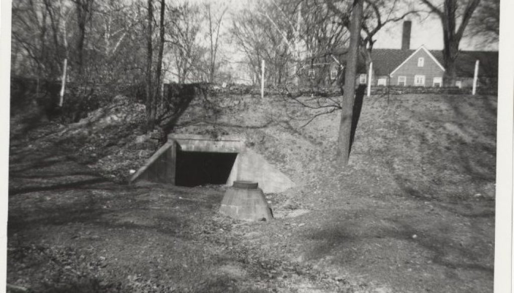
In the 1870’s, an attempt was made to build a brewery on the side of the hill that borders Durkee’s Run on the south near the Fourth Street road but the plant was never finished. For many years the partly finished excavation in the side of the hill was reputed to have been used as a rendezvous for robbers, especially horse thieves. This hill has since been known as “Brewery Hill.” (3)
Along in the late 1860’s Durkee’s Hollow began to attract public attention because it was reported to be the hiding place of $96,000 in gold which a gang of desperados secured when they robbed an Adams Express Car in Scott County and came north with the treasure. Every few years since then searchers have been combing the valley seeking for this treasure but with no luck.
The major part of the land in Durkee’s Hollow has been owned by the Owen Ball family for three generations. Today, well screened from the Fourth Street road by trees and bushes, it presents quite a different appearance from what it did more than a century ago when it was the scene of teeming industry. [At the time of Mrs. Harlan’s writing, the construction of Three Sons Shopping Center in 1957 was eight years in the future.] It has retained, however, much of its rugged beauty-the hillsides are still wooded and large sycamores grow along the stream, but the bottomland has long been cleared and here there is a small cornfield and some waste pastureland.
A narrow road branching off from the Fourth Street road leads to a small house in its depths; truly a secluded place to live to be so near a busy thoroughfare. (4)
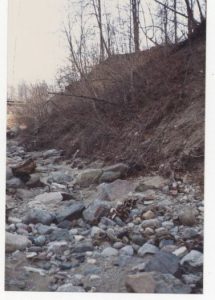
Durkee’s Run today is a clear swiftly moving little stream, except after heavy rains when it becomes a raging torrent. (5) It is reported that after one freshet years ago, some cattle were drowned near where it enters the tunnel under the railroad tracks. All unmindful of the passing of time and the changes wrought along its course, it still merrily wends its way through the hollow to join the Wabash.(6)
Dr. John Durkee, for whom this historic little stream was named, died in February 1834. He was 64 years old. He was buried on his own farm near his residence not far from Shadeland, “where,” as Dr. Reser said, “the timber of the ridge met the prairie of the plain from which spot the view during life always enchanted him.” Other graves are found on the plot and it has long been known as the “Old Durkee Cemetery.” It has been sadly neglected and is now overgrown with bushes and trees.
(1) Booklet: “The Old Junction House, Pearl River and other papers” by Mabel L. Harlan. Published by Tippecanoe County Historical Association, Lafayette, IN, 1954.
(2) The old barn on the St. Joseph Orphanage grounds has been restored for use as a family recreation center by its owners, Louis and Maxine Alt, 2120 Freiburger Lane. The property for the orphanage was donated by Owen Ball and J.B. Falley in 1875.
(3) William T. Ball (1876-1970), grandson of Owen Ball, in 1966 and 1969 wrote his memories of various aspects of life in the Durkee’s Hollow area. These remembrances, deposited with TCHA, provide a delightful insight into this area and help clarify some information contained in Mrs. Harlan’s account. He wrote, regarding the old brewery, “As a young boy, possibly around the year 1884, when I was 8 years old, I first saw what there was of this structure, and which was considerably more than an ‘excavation’… There was a completed cellar, possibly ten feet in height, covering the whole ground area where the building was eventually to rise… The ceiling was a series of arches filled in above with brick and cement to make up the first floor above the cellar. And the floor of the cellar was cool and quite dark down there. An arched approach, composed of brick, entered at the north. This arch was allowed to stand when the debris of the building was disposed of and it was used for many years thereafter as a cold cellar by people who built a house there. The brick walls of the brewery building were erected to what seemed to me two stories in height.”
(4) In 1969, after reading Mrs. Harlan’s account of Durkee’s Run, Mr. Ball wrote, “As a kid, who had Durkee’s Run as a playground, our legend was that a family named Durkee lived on that land in the valley of the stream known as Durkee’s Run but called “the Crick” by us youngsters. And, of course, we thought the Durkee family buried its dead on the knoll at the west end of the fenced in hog farm, occupied and operated by a man named Joe Wieners and a fairly large family. This strip of land had on it a five room house, described by Mrs. Harland as a “small house” and which was eventually burned down by vandals not so long ago [between 1949 and 1969], the occupants losing all of their furniture…. Now the question is whether we kids were right and this really was the Durkee home and cemetery, or is there another location entitled to that honor?” [Dr. John Durkee’s home and burial place are located quite a ways from the Durkee’s Run area, relatively near Shadeland, as Mrs. Harlan states. The Durkee Cemetery is located at the intersection of 375 W and 450 S in Union Township. Apparently the house and small burial ground Mr. Ball describes belonged to someone else.]
(5) Durkee’s Run continues to become a raging torrent in times of heavy rains since, in the fall of 1981, one such storm and its attendant high, rushing water took the northwest corner out of the building owned by Prairie Farms on South 4th Street.
(6) Mr. Ball’s memories of Drukee’s Run provide a sentimental picture of life as a young boy in the late 1800s. He wrote, “[It was] a delightful place to play. A big portion of the cold, clear water came out of the tall banks on the south shore, and thousands of minnows, each group composed of those of one size, could be seen fluttering in the babbling waters. Frogs, tadpoles, crawdads and turtles abounded in the stream or its environs, and even water snakes of a non-poisonous kind were sighted and probably killed because our code required such execution. Kingfishers had their nests in holes bored in high, black banks. Eventually residence sewage and manufacturing residue turned into the creek killed all water life, even the bugs we called “skate bugs” because they looked like men skating on ice as they glided on top of the water. The water pollution and the discoloration and even stench accompanying it put an end to the fun the kids used to have making dams, or digging channels and lakes and bays in the sand. Since the construction of the city sewage disposal plant [1956], the creek water (now mostly from springs), is cleared and kids play there again. However, the last time I investigated [1966], the minnows at least had not returned.”

